
Gibraltar
Six million years ago, the African tectonic plate collided with the Eurasian plate, transforming it into a lake and draining the Mediterranean Sea. Later, an unstoppable force — the Atlantic Ocean — will break the rocks and form the Strait of Gibraltar.
Six million years later, Adolf Hitler will once again attempt to close off Gibraltar, but he will encounter another insurmountable force — Great Britain.
Jurassic Hercules
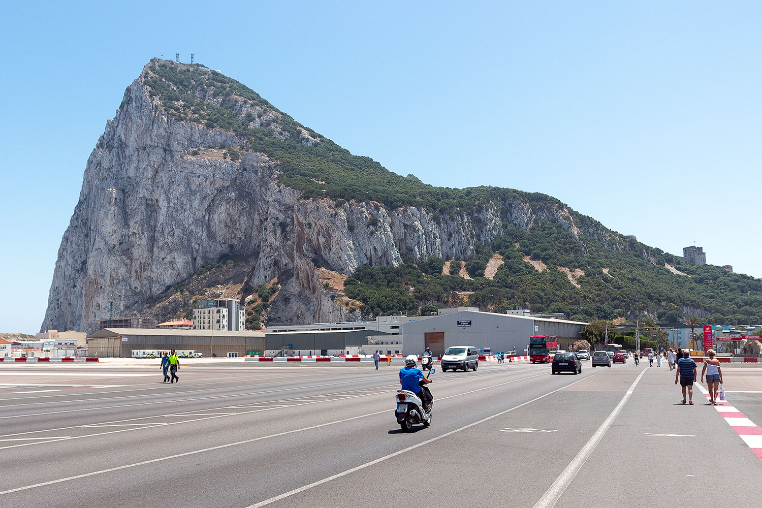
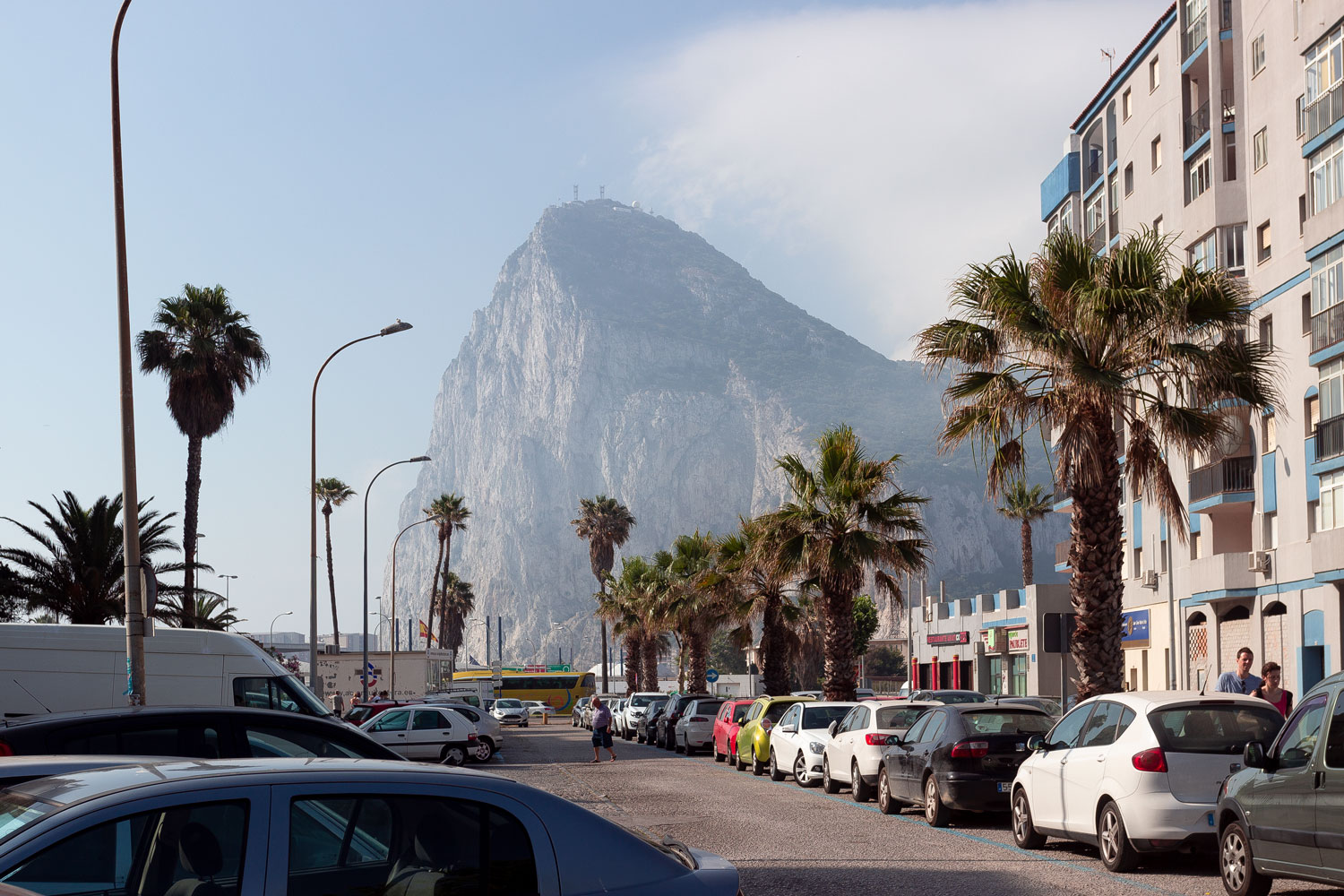
On the horizon of the perfectly flat Spanish city of La Línea, out of nowhere, from a haze, from the morning mist, emerges a gigantic, solitary rock. There is nothing around the rock, and it seems as if it does not exist, hovering as a mirage in the atmosphere.
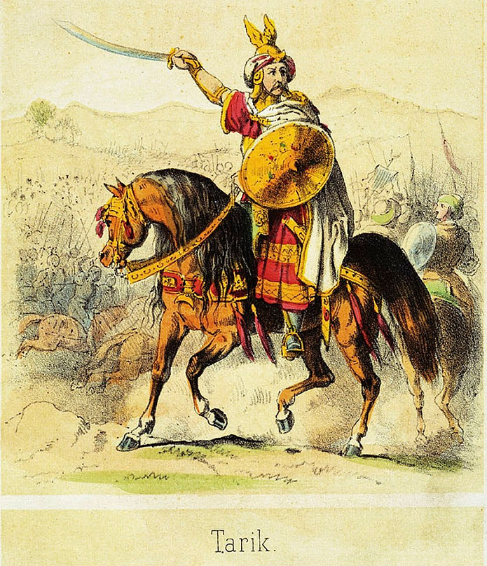
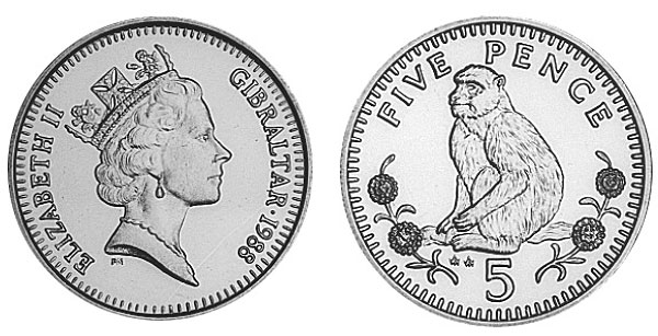
The name of the rock, as well as the dwarf state that surrounds it — Gibraltar — derives from the Arabic “Jabal Tariq.” “Jabal” translates to “rock,” and Tariq was the name of an Arab military commander who once conquered the future Spain. It’s as simple as that.
The Strait of Gibraltar is symmetrical: on the other side of Spain lies the country of Morocco, with a piece of Spanish territory embedded in its border — an enclave called Ceuta. Not far from Ceuta is Mount Musa, which is almost a replica of Mount Tariq.
These two symbolic mountains, located at the very exit of the Mediterranean Sea, form the basis of many Greek myths. The most famous one is the tenth labor of Heracles, where Heracles, or Hercules, had to steal the cattle of the giant Geryon and bring them to Greece for his cousin, likely during the Kurban Bayram holiday.
According to the legend, Heracles reached the very edge of the world, and when he encountered the Atlas Mountains in his path, he did not engage in mountaineering. Instead, he struck them with such force that the mountains split open and formed the Strait of Gibraltar.
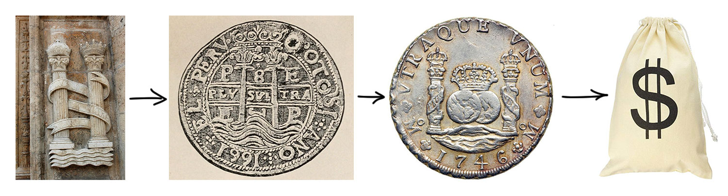
Beyond the strait, Atlantis was situated, and thanks to Heracles’ feat, the two mountains on the western end of the strait have another name — The Pillars of Hercules. Their symbolic depiction can be found everywhere, from ancient paintings and frescoes to the Spanish coat of arms.
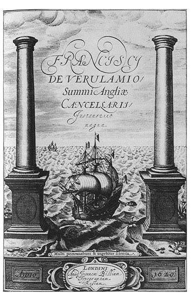
But the most famous depiction of the Pillars of Hercules is the dollar sign. The origin of the symbol is not definitively known. It is only a hypothesis, but a very convincing one: the evolution of the symbol can be traced well in Spanish symbols and coins.
The legendary version of Gibraltar’s creation is beautiful and close to reality. The mountains were indeed once shattered by a superhuman force, but it was not Heracles, rather the Atlantic Ocean itself.
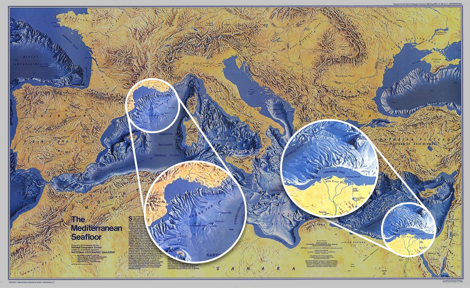
The mountains near the strait began to form 200 million years ago during the Jurassic period. Much later, six million years ago, the African and Eurasian tectonic plates collided at the site of Gibraltar, resulting in the Mediterranean Sea being isolated from the global ocean and turning into a lake.
This period is known as the Messinian Salinity Crisis. During this period, the Mediterranean Sea nearly dried up for a pitiful thousand years. The sea’s depth reached 3 to 5 kilometers, resulting in atmospheric pressure on the dry basin being one and a half times higher than normal, with temperatures reaching 80 degrees Celsius. Huge salt deposits formed on the dried-up bottom, and the remaining water was as salty as the Dead Sea.
Reader, have you ever wondered where geologists get all this knowledge from?
In reality, geology, like astronomy, is a science of observations. Astronomers literally “see” events from the past through telescopes because the speed of light is finite. Similarly, geologists “see” or rather read events that occurred on Earth millions of years ago.
Firstly, the Mediterranean Sea is slightly saltier than the Atlantic Ocean even today, but the main point is the deposits of calcium sulfate found on the seabed, which could not have formed at temperatures below 58 degrees Celsius.
Secondly, take a look at the underwater canyons formed by major rivers, such as the Nile: its delta extends far into the sea, intricately carving the seabed with canyons that reach depths of 2.5 kilometers. However, rivers do not flow underwater. The areas where these streams exist were once land.
Finally, some dwarf hippos appeared on the islands: Cyprus, Crete, and Malta. This is an example of island dwarfism. When an animal ends up on an island where there are no predators, natural selection stops working: not only large and strong individuals survive, but also all others.
And so, in the absence of predators, hippos lost their size on Malta, but first they had to get there. There were no migrants from Africa at that time, so they couldn’t have taken a hippo with them. Therefore, they reached the island themselves. Over land.

And then a global flood happened, which, however, was far from biblical. The Atlantic Ocean ruptured the junction of tectonic plates, and waves flooded into the Mediterranean Sea basin.
The water level in the resurrected sea was said to rise by 10 meters per day. The climate changed significantly. The Nile Valley was flooded, and the streams and canyons of former rivers disappeared. Only two fragments remained on opposite shores of the strait from the mighty mountains. Hippos remained on Malta, shrunk, and died.
The Strait of Gibraltar was born.
The key to Stalingrad
Now Gibraltar is not just a rock, but a dwarf state, an overseas territory of the United Kingdom, a remnant of the former British Empire.
The English call Gibraltar simply “the Rock.” The Rock did not always belong to them but was wrested from the dying Spanish Empire in the early 18th century. Since then, at least three peace treaties have been signed recognizing Gibraltar as part of Britain, and there have been dozens of verbal acknowledgments and confirmations.
The Spaniards, with their wounded pride over the lost empire, have disregarded any treaties and are very eager to reclaim Gibraltar for themselves. However, they fail to consider that arguing with Britain over matters of ownership is akin to arguing with Russians about the stronghold of vodka.
The Spaniards claim that according to the peace treaty, Gibraltar is only the city and castle on the mountain. Indeed, the treaty states this. And the matter would have been settled there if the British hadn’t unearthed the “customs of business dealings” of the 18th century, from which they derived that territories were ceded at that time taking into account the surrounding area within a radius of two cannon shots.
The Spaniards, upon hearing such a statement, took about 200 years to ponder and tried to find documents suggesting that in the 18th century, cannons were loaded not with gunpowder but with tequila, hence the projectiles didn’t fly too far. However, they couldn’t find them in time, as the Spanish Civil War led by fascist Franco got in the way.
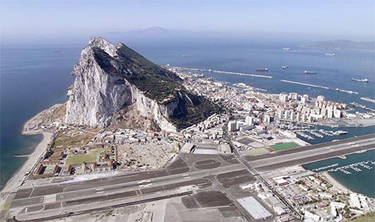
After the war, it was suddenly revealed that Britain had secretly constructed a gigantic military airfield right across the isthmus, and now one can only access Gibraltar by crossing the runway.
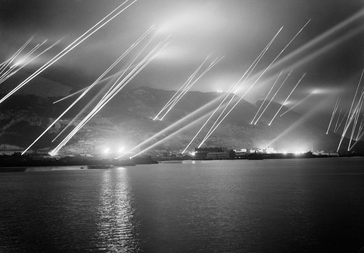
These events took place in September 1939, when the Second World War was just beginning its bloody campaign across Europe. Great Britain already understood the strategic importance of the Rock. Germany also recognized its significance. The plan of the Third Reich to seize Gibraltar was called Operation Felix.
The Second World War brings forth many intriguing details concerning this aspect, which are not widely known, and it is challenging to provide a comprehensive account of all the intricacies.
The thing is, General Francisco Franco, who seized power in Spain, although he exhibited all the characteristics of a fascist and was considered a puppet of the Third Reich, was actually a true “wild card” during the war.
Franco seized power in Spain by winning the civil war. In this war, he fought against the Spanish Popular Front, a coalition of socialists, communists, and sympathizers supported by the Soviet Union. Franco himself was supported in the war by Hitler and Mussolini. The civil war lasted for three years and claimed the lives of 450,000 people. The regime established by Franco after his victory was a harsh military dictatorship that lasted until 1975, leaving Spain in international isolation and causing significant damage to its economy.
The Spanish Popular Front, in turn, received support from the USSR: 650 aircraft, 350 tanks, 20,000 machine guns, 500,000 rifles, and 150,000 bombs were supplied. Approximately 2,000 Soviet citizens also participated on the side of the Spanish communists. Apparently, the support from the Soviet Union was indeed significant, as after Franco’s victory, he even said:
So, with the help of Franco Hitler planned to capture the Strait of Gibraltar in order to completely surround the Mediterranean Sea. But what happened next is hard to believe. The events unfolded in such a way that Francisco Franco, a fascist who was essentially brought to power by Hitler, subtly and diplomatically rejected any form of involvement in the war.
Then Hitler sent Wilhelm Canaris, a high-ranking intelligence officer, to negotiate with Franco with the task of at least convincing him to allow the Wehrmacht to pass through Spain in order to capture Gibraltar.
Instead, Wilhelm Canaris — once again, a high-ranking military officer of the Third Reich — came to Franco and told him not to even think about getting involved in the war because Hitler was a deranged fool, and Franco would undoubtedly suffer defeat along with him when Germany lost.
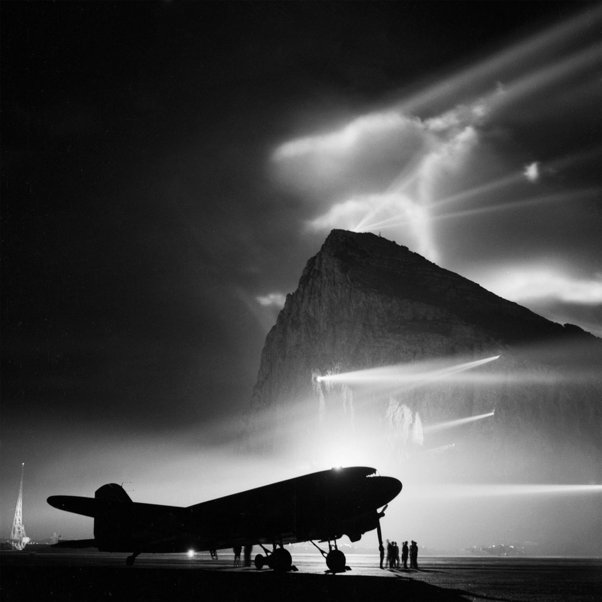
As a result, after lengthy “negotiations” with Franco, Hitler failed to reach an agreement on capturing Gibraltar. Both sides also feared Britain. The British could have potentially initiated a war with Spain, and Gibraltar itself — that piece of rock — was heavily fortified and prepared for war. Felix Hitler never launched the operation, deciding to carry it out after the victory over the USSR.
Among all, Hermann Göring expressed the greatest regret about the cancellation of the operation. He stated that the plan to capture Gibraltar was meticulously developed and would have allowed for the conquest of the entire North Africa. He pleaded with Hitler to first take Gibraltar and then attack the Soviet Union, assuring him that it would determine the outcome of the war. Göring considered the cancellation of the operation to be Hitler’s biggest mistake.
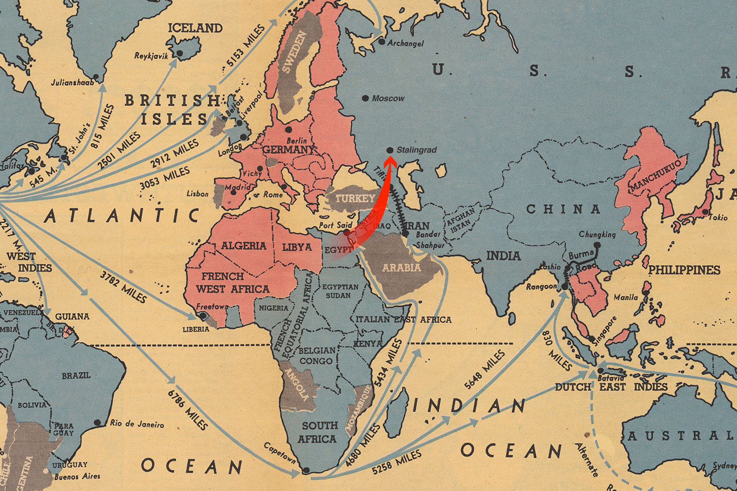
So, what would have happened if Hitler had taken the strait?
Most likely, it would have severed the supply lines for the British and American forces fighting against Hitler in North Africa. The Nazis would have taken control of the Suez Canal and captured the oil fields in the Middle East and Caucasus. Until 1941, almost two-thirds of all the oil consumed by Germany came from the Soviet Union. After attacking the USSR, the Third Reich lost its main source of raw materials. If the Nazis had managed to break through into Arabia, Syria, and Iraq, it would have provided them with ample resources for their needs.
If Gibraltar had been captured, the Soviet Union could have potentially lost the Battle of Stalingrad.
The victory in this tremendous battle, which lasted for 5 months, hung by a thread. If Hitler had captured Gibraltar, cutting off North Africa from the British fleet and seizing the Suez Canal, the German Nazi forces would have easily advanced towards the Caucasus and struck at Stalingrad from the south and west — precisely from where the Soviet offensive had come.
All of this, however, is alternative history.
⁂
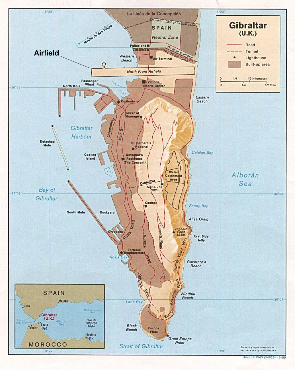
To reach Gibraltar, one needs to get to the Spanish town of La Línea and cross the international border. There it is, right in the middle of the street.
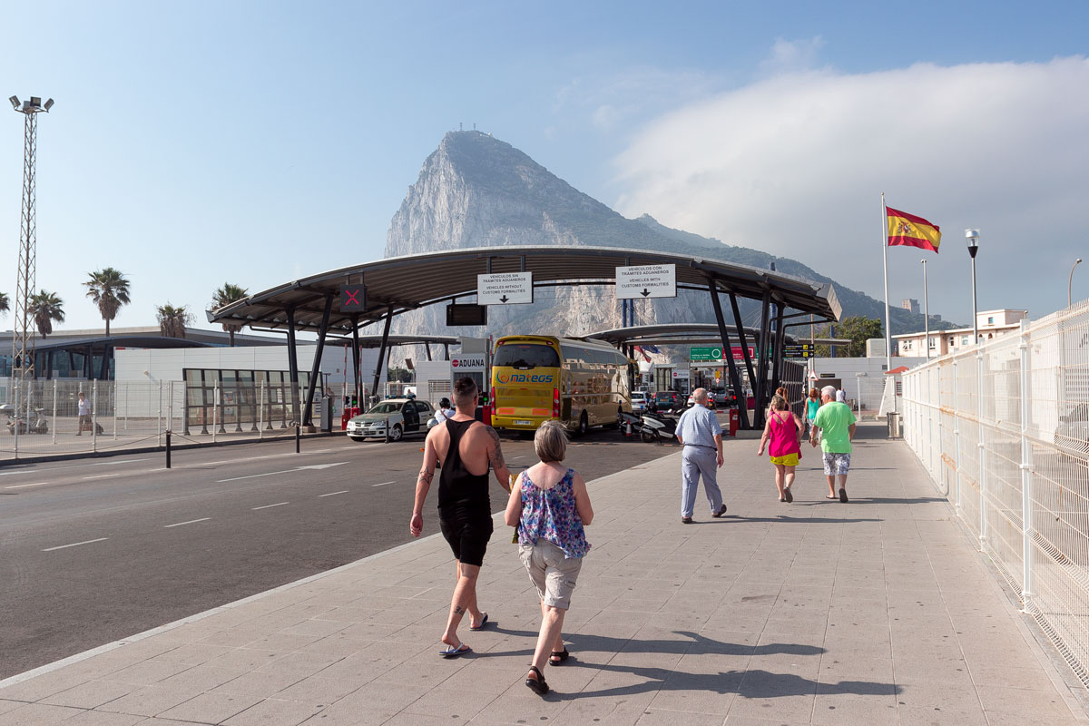
Citizens of the European Union have free entry. Tourists from Russia must show a passport with a Schengen visa — after a brief inspection, they are allowed to enter with the condition of returning on the same day.
The surrealism of Gibraltar begins immediately. The first thing a traveler sees is a traffic light for airplanes and a pedestrian crossing over the runway.
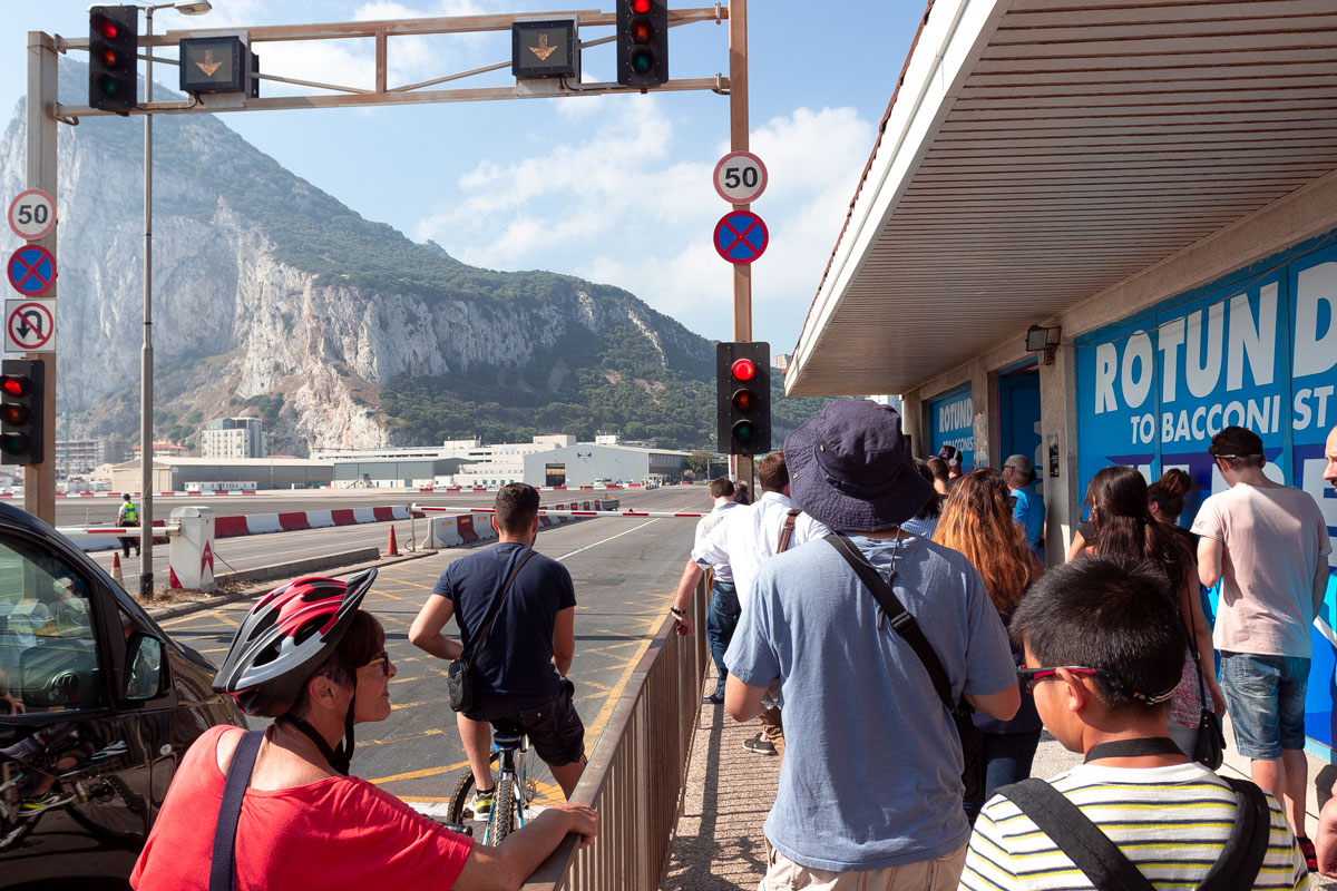
We patiently wait for the passenger plane to pass and take off, and then we proceed.
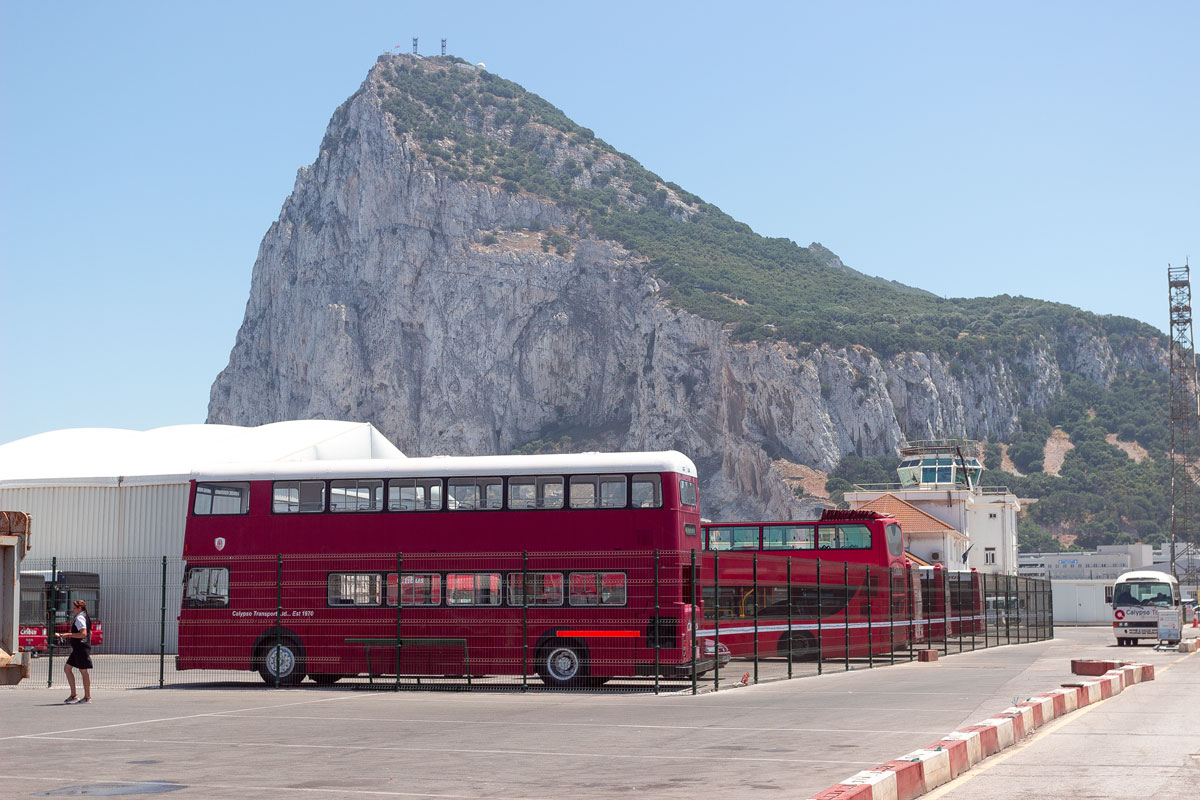
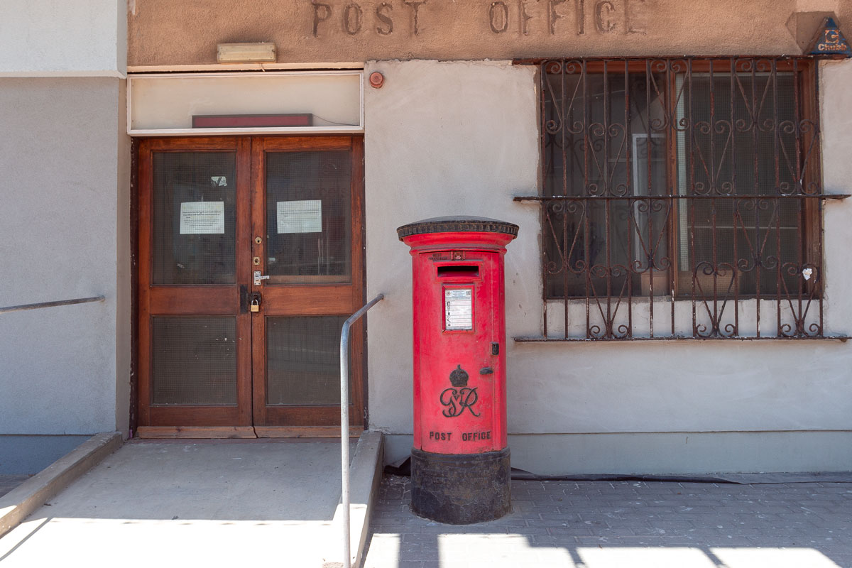
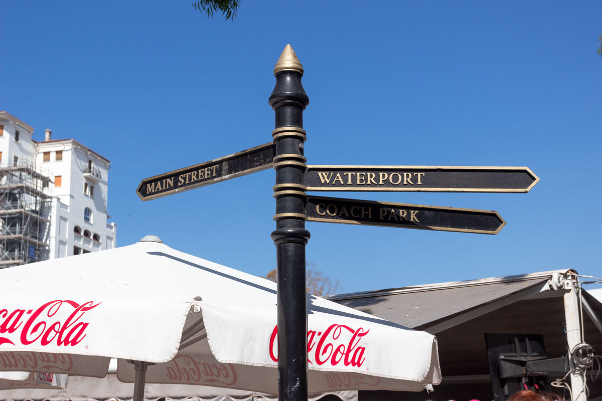
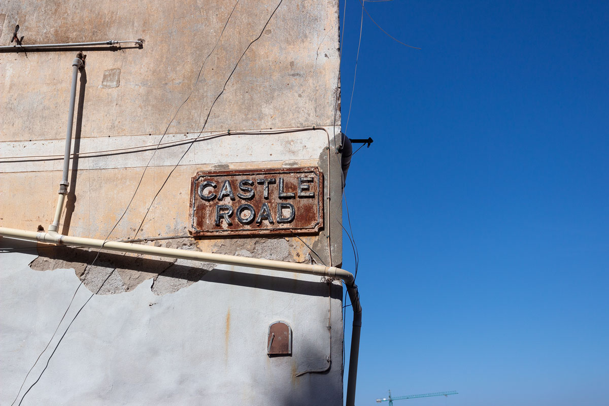
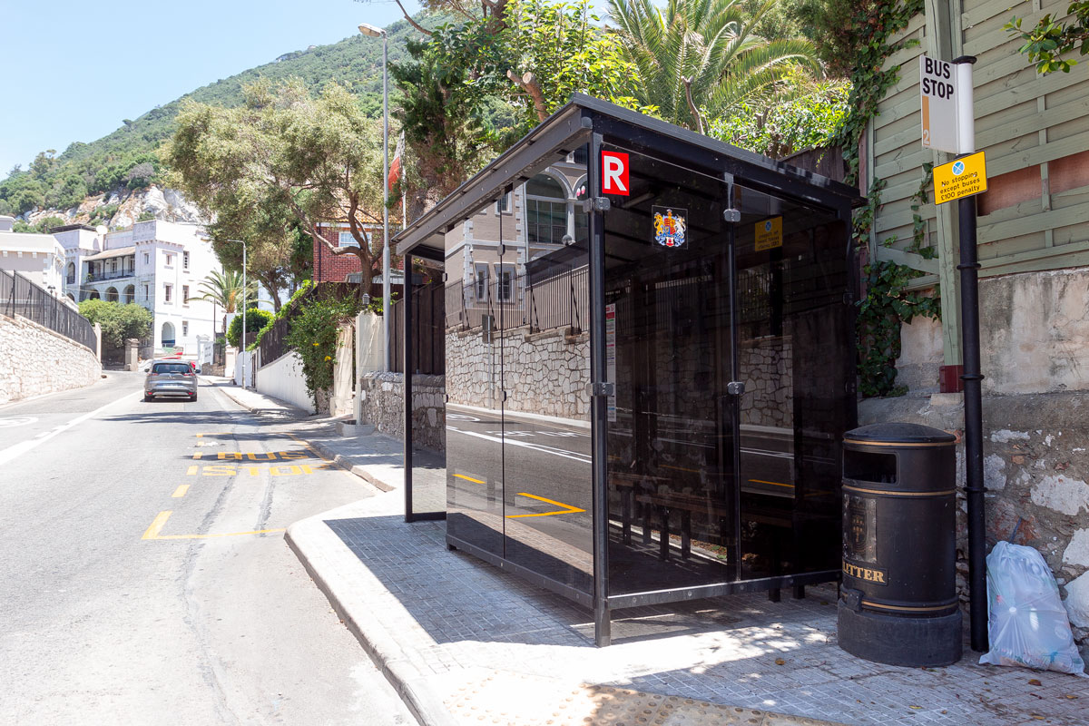
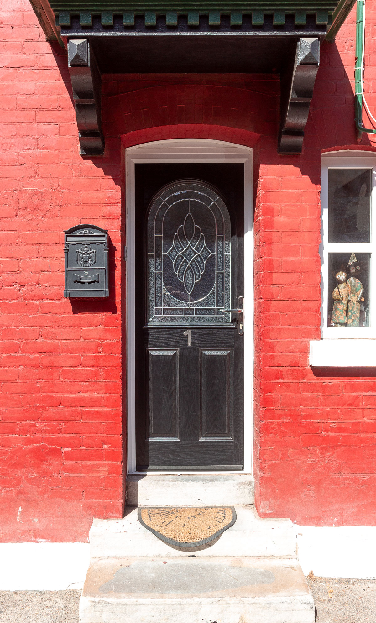
And after crossing the airfield, England presents itself to the tourist as it is. Red double-decker buses are parked in the parking lot, red telephone booths dot the city, along with royal mailboxes and vintage street signs with an elegant font.
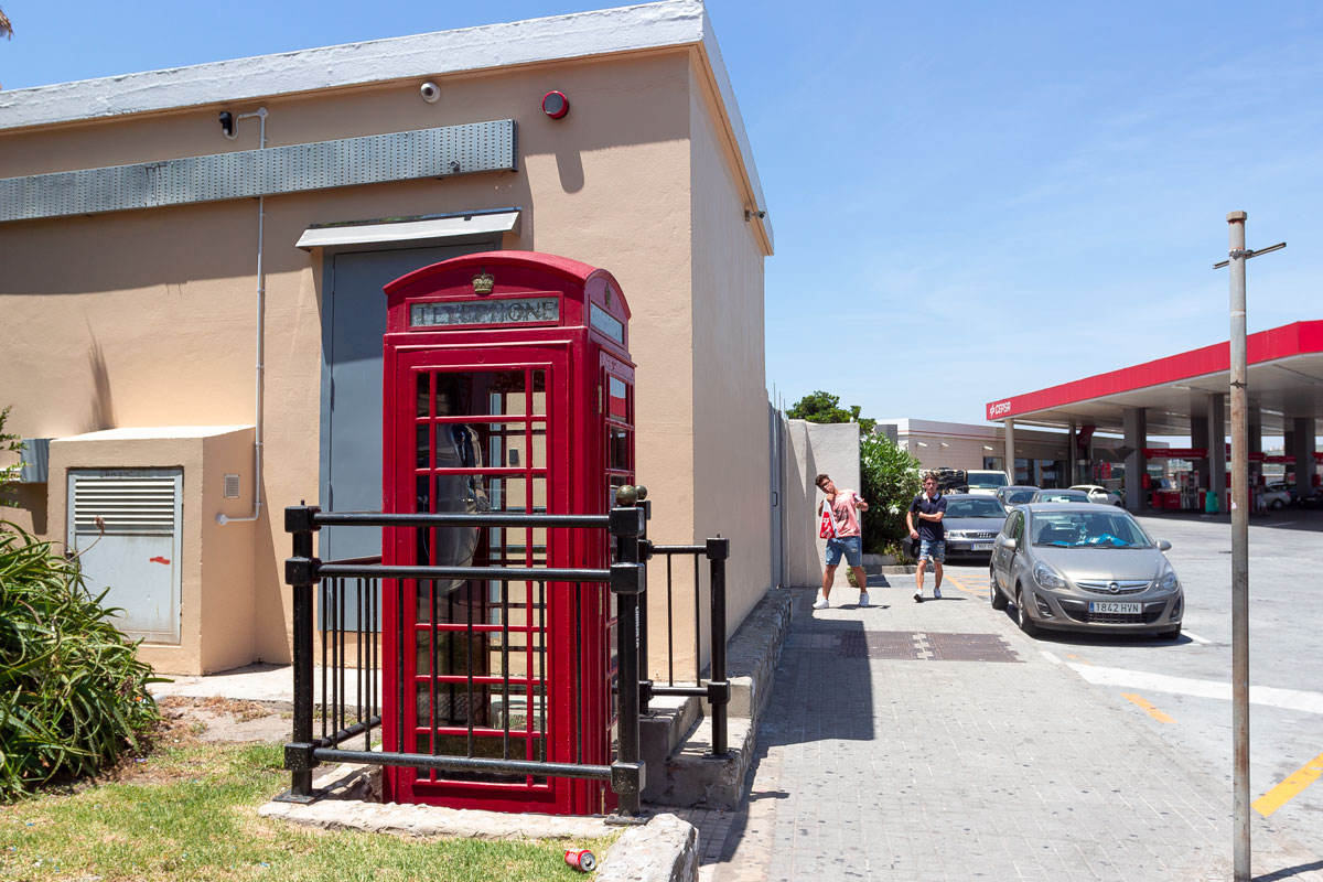
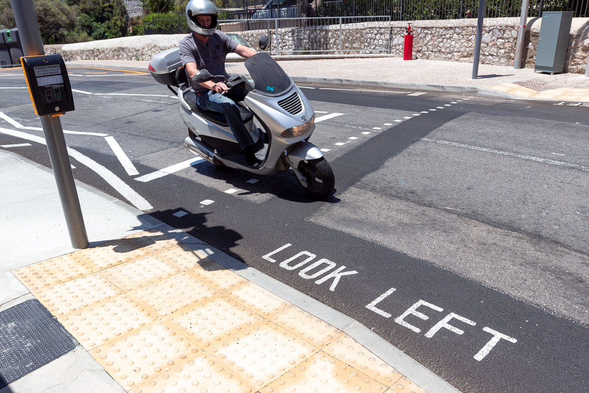
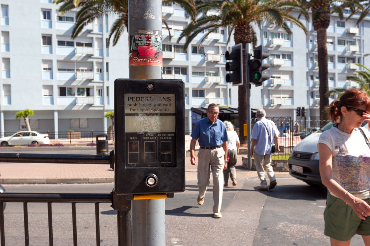
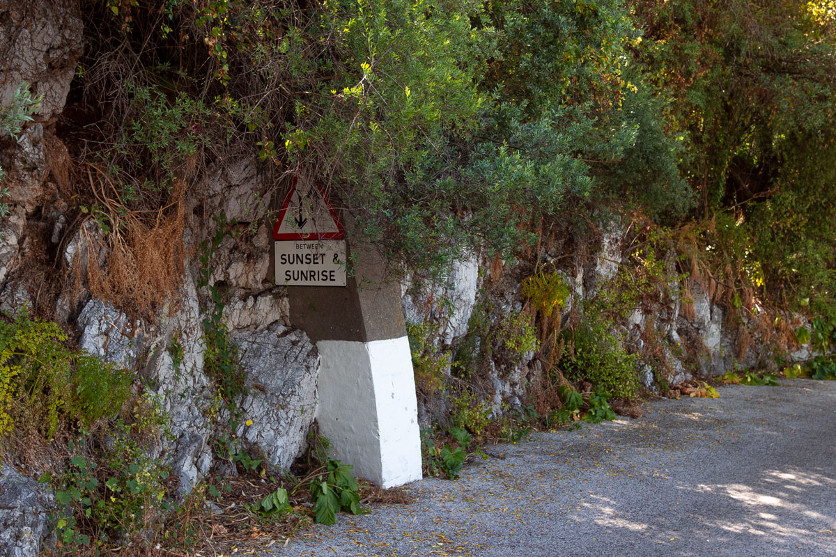
In Gibraltar, just like in London, left-hand traffic prompts the need to write “Look Left” on every pedestrian crossing. Buses stop at incredibly stylish bus stops, and the traffic lights are adorned with vintage British placebo buttons. Alongside the mountain road, there is a sign sticking out from the roadside that reads “↑↓ From dusk till dawn.”
English formalism. I missed it.
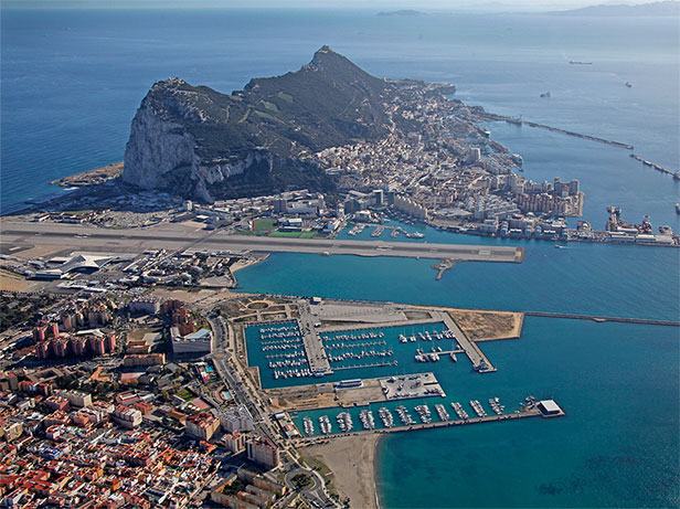
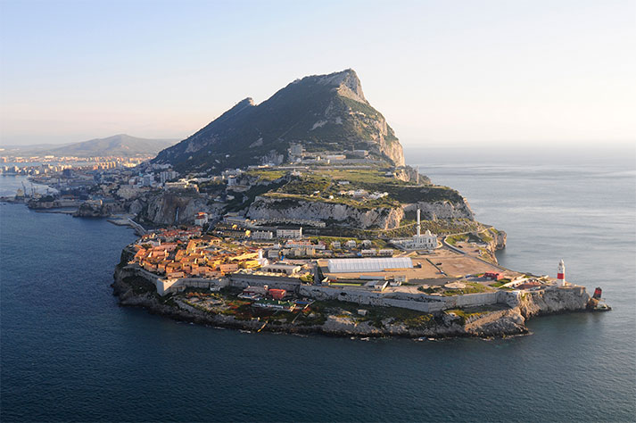
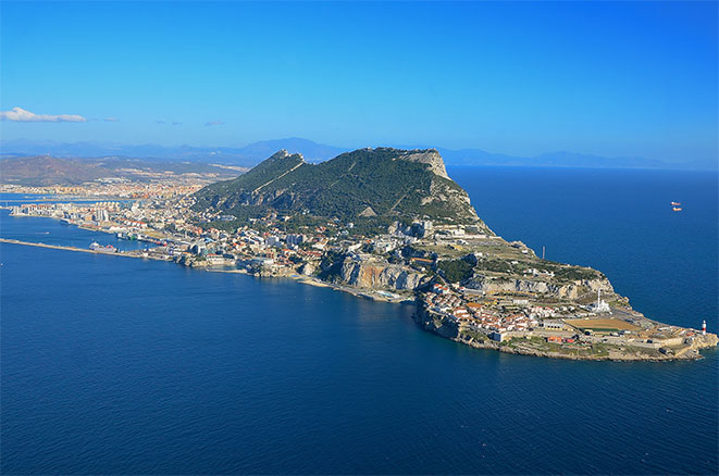
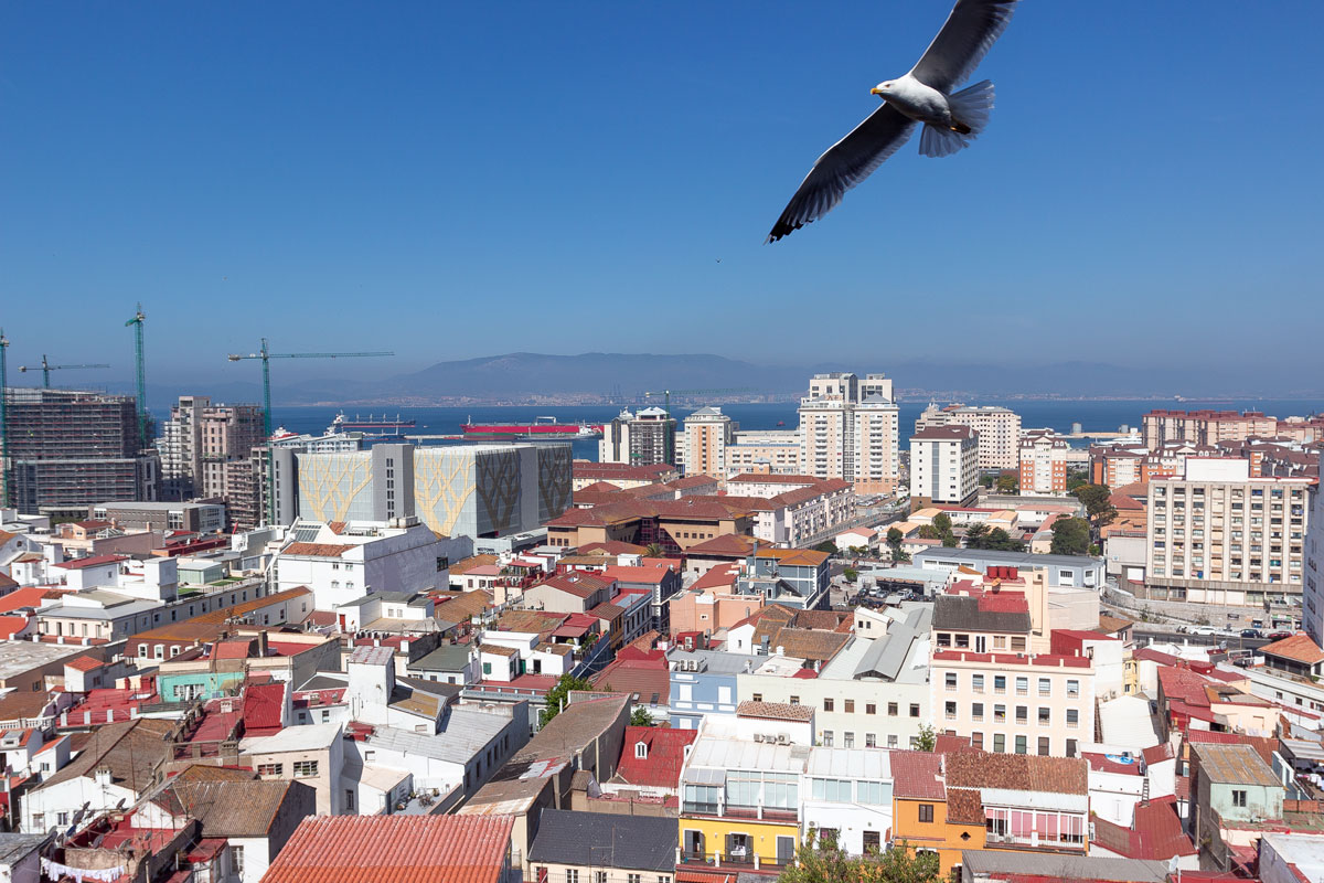
The city of Gibraltar stretches along the western foothills of the rock. From this side, the rock is gentle, while on the east side, it sharply drops down, and apart from the road and a few buildings, nothing can be constructed there.
The shape of the rock is so peculiar that no matter how you look at it, there is still a strange sensation: as if you can’t spot some kind of secret in it.
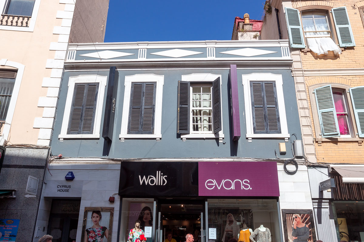
The urban development in Gibraltar is dense and resembles England only in minor details.
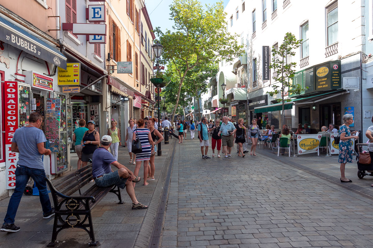
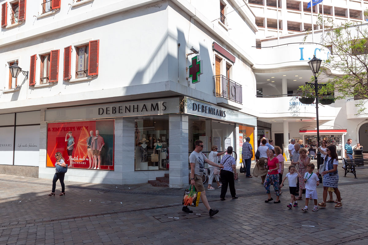
In addition to mailboxes and telephone booths, the city is full of Fish and Chips cafes. Of course, there is a Debenham’s supermarket, a Top Shop clothing boutique, and other British brands. The streets are cluttered with non-British shops: Gibraltar has Apple, McDonald’s, numerous pizza places, and tons of electronics stores.
Gibraltar is a well-known offshore location. There is no VAT here, so it’s an excellent place for shopping. The latest model of iPhone X in Gibraltar costs 150 euros less than in Madrid.
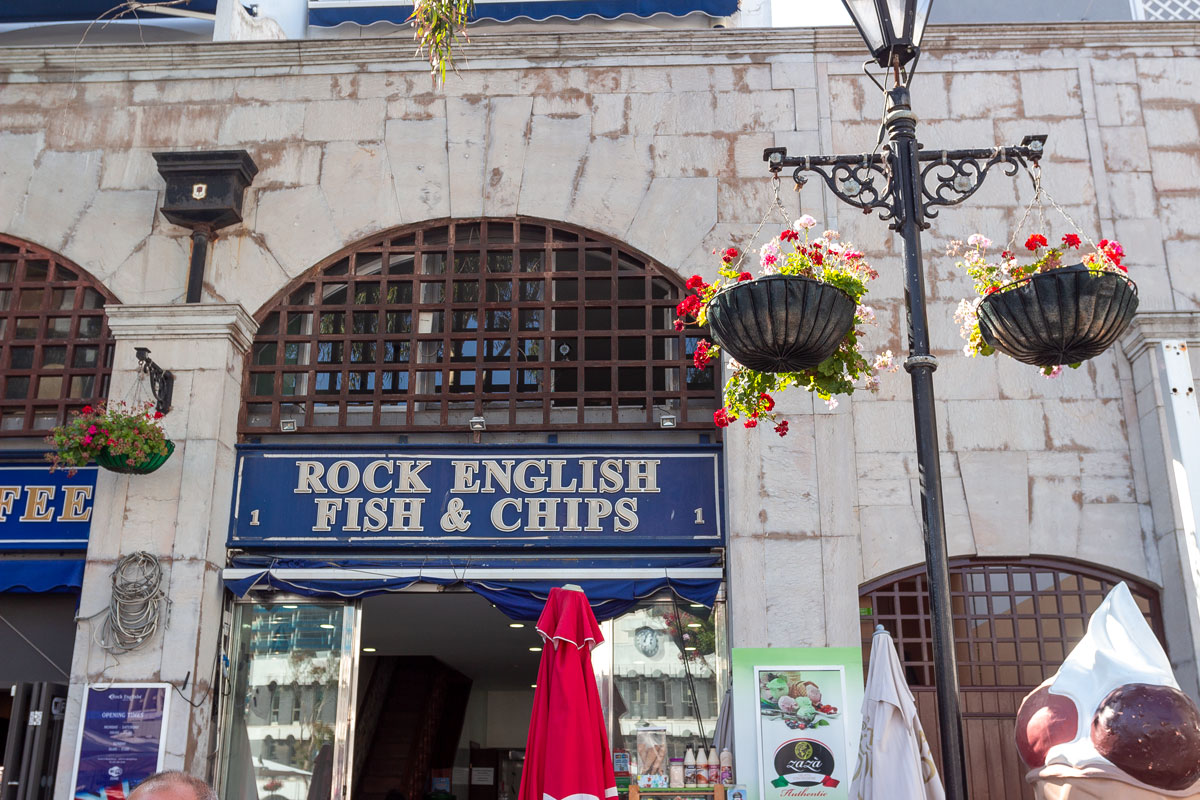
The coloring of the facades slightly resembles England, with rare ornaments on the walls, half-Spanish shutters and balconies, and colorful doors with a royal mailbox.
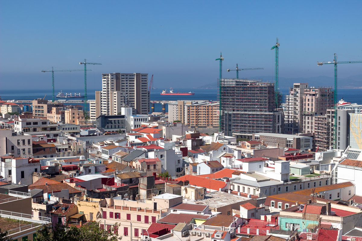
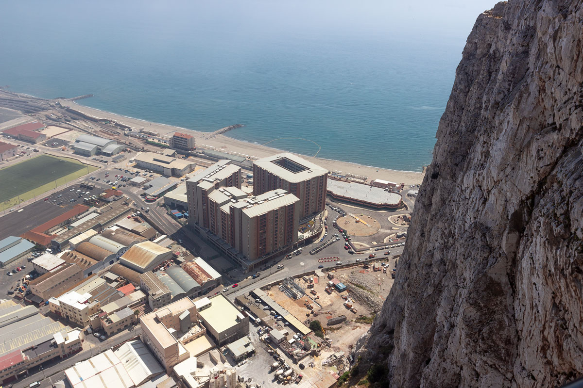
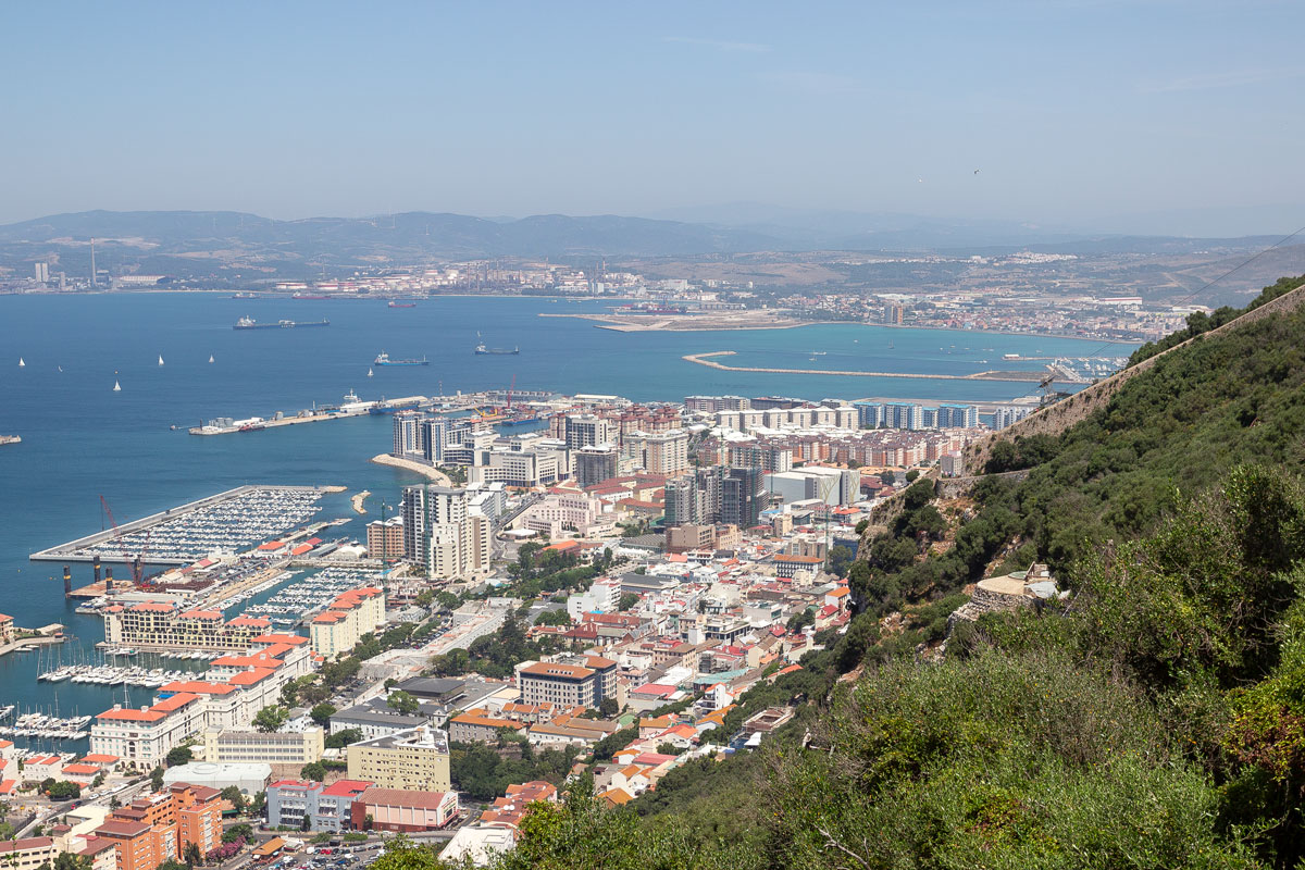
That’s where the similarities with Great Britain end. Just a hundred meters from the central streets, panel buildings begin, often quite tall: after all, 32,000 people live on this tiny island.
From a height, the city looks quite steep.
On the other hand, no one comes here to see the city. The coolest things in Gibraltar are all located on the rock.
I assert that the Gibraltar Rock, which is much smaller in size than the average Russian oligarch’s country estate, contains a gigantic, colossal number of interesting places. You won’t have enough time in a single day to see everything.
What can also be seen from the foot of the rock is the castle wall and tower, resembling a typical English castle from the seventeenth century.
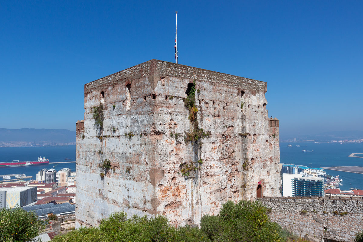
When it turns out that the castle was actually built by the Moors in 711 AD, that’s when your jaw drops to the floor.
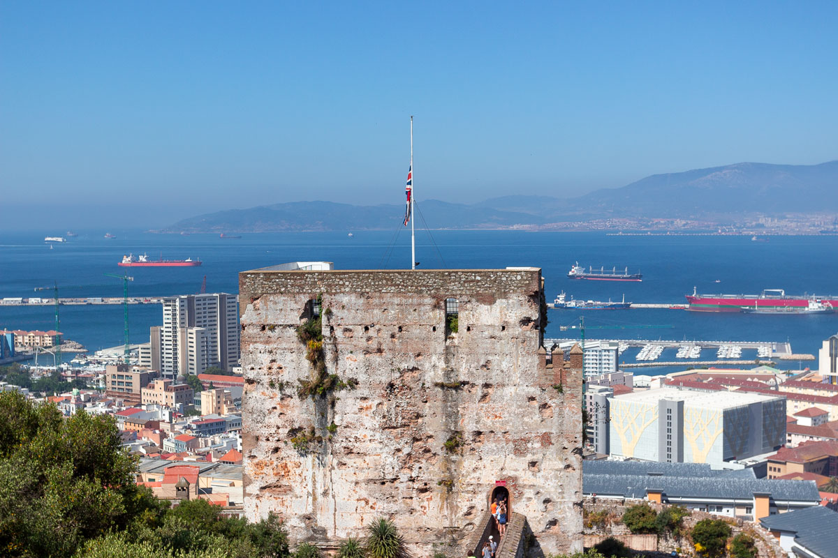
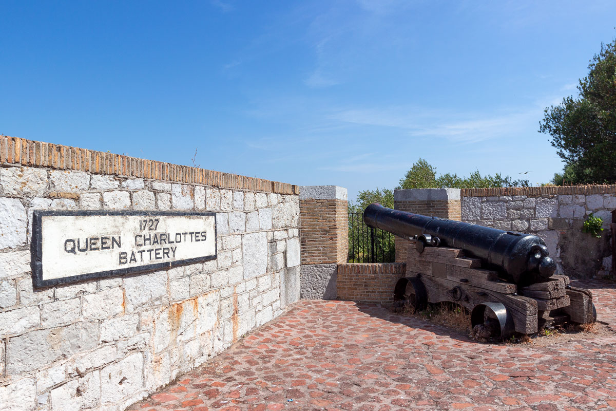
This is the very fortress from which two cannon shots were fired during a dispute with Spain.
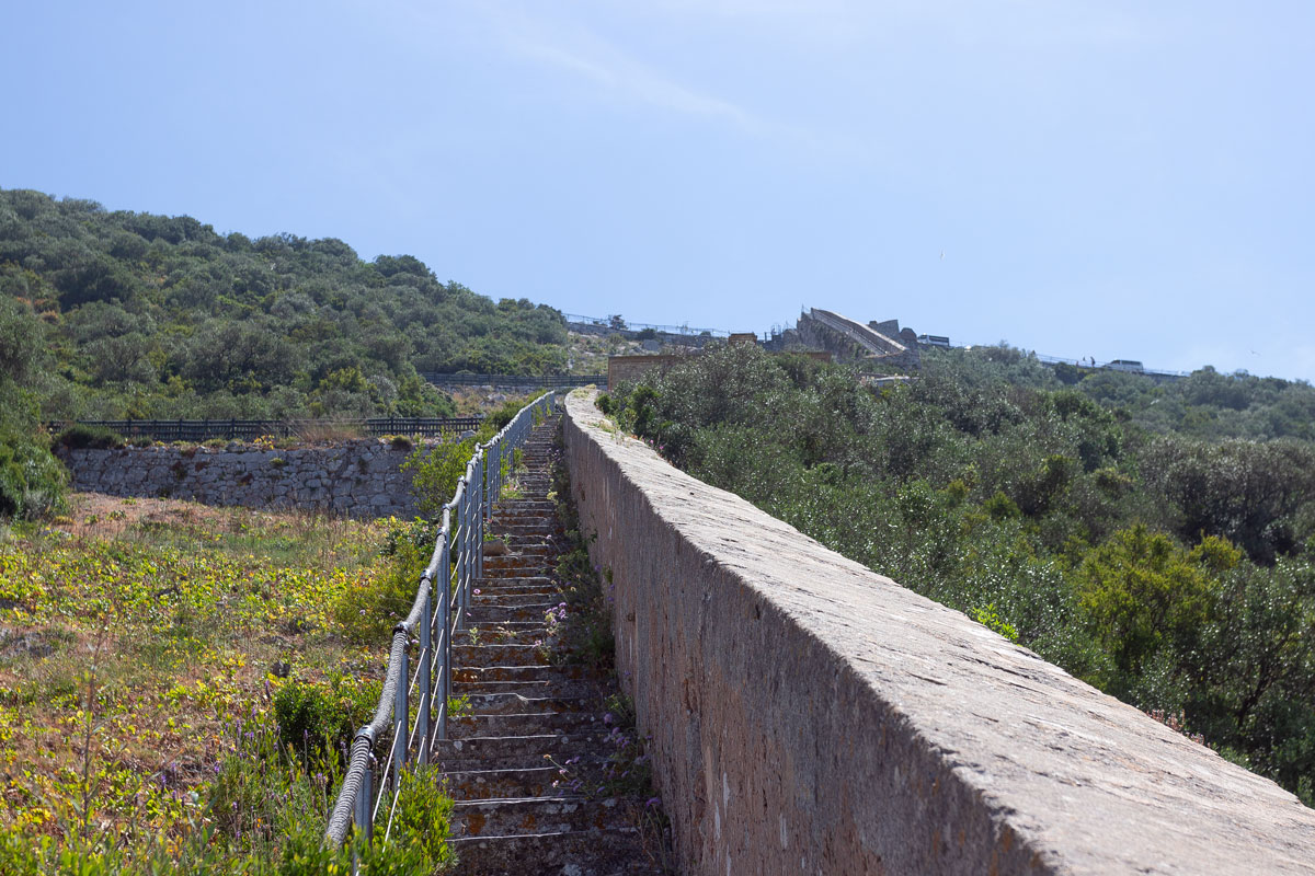
The castle was only the beginning of the mountain, and I was already gasping for breath from climbing the steep slope.
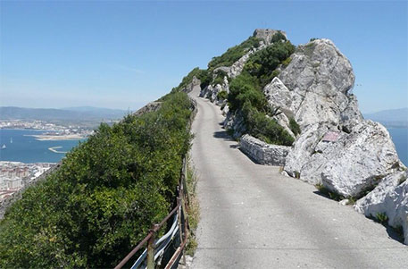
The Gibraltar Rock is a complex, road and trail-laden territory, well-maintained as a national park. Even just taking a walk on the rock incurs a fee of 1 pound. That’s why the rock is kept in excellent condition.
You can stroll around the rock for a whole day. Firstly, because it’s challenging to move around the mountain. Secondly, due to the intricate paths and various places. From a height, the Gibraltar Rock looks fantastic: as if an ordinary park with streets, squares, and attractions was scraped off the surface and stretched over a complex mountain landscape — like in the movie “Inception,” well, almost.
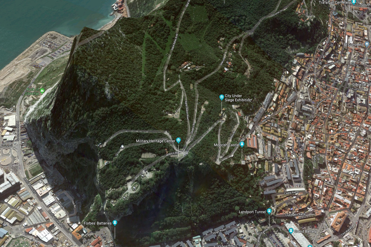
At the very top of Gibraltar is a British military base, and access to it is closed. It is only possible to partially ascend the rock, but even here, one’s breath is taken away.
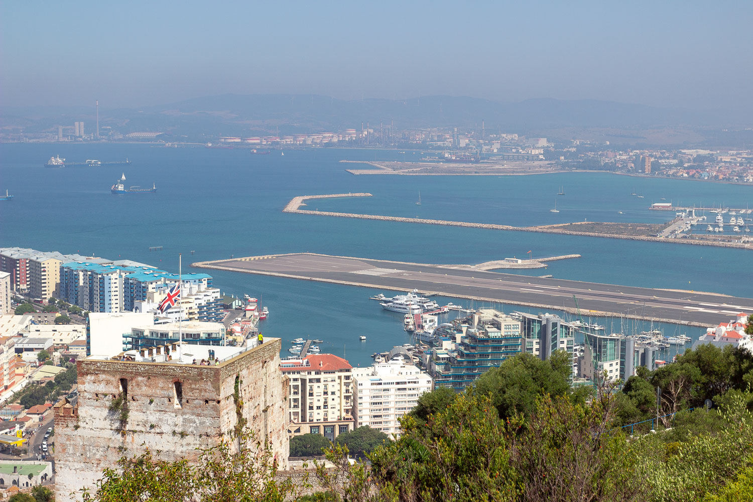
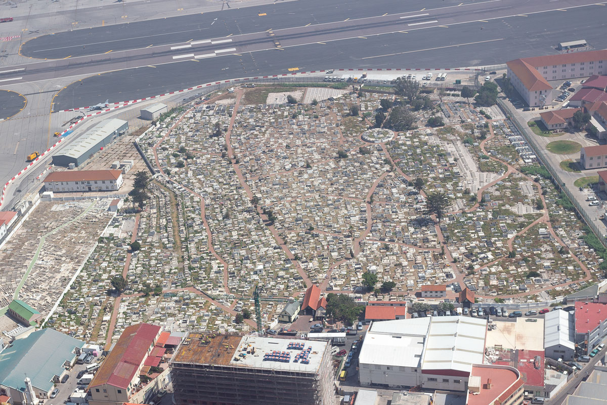
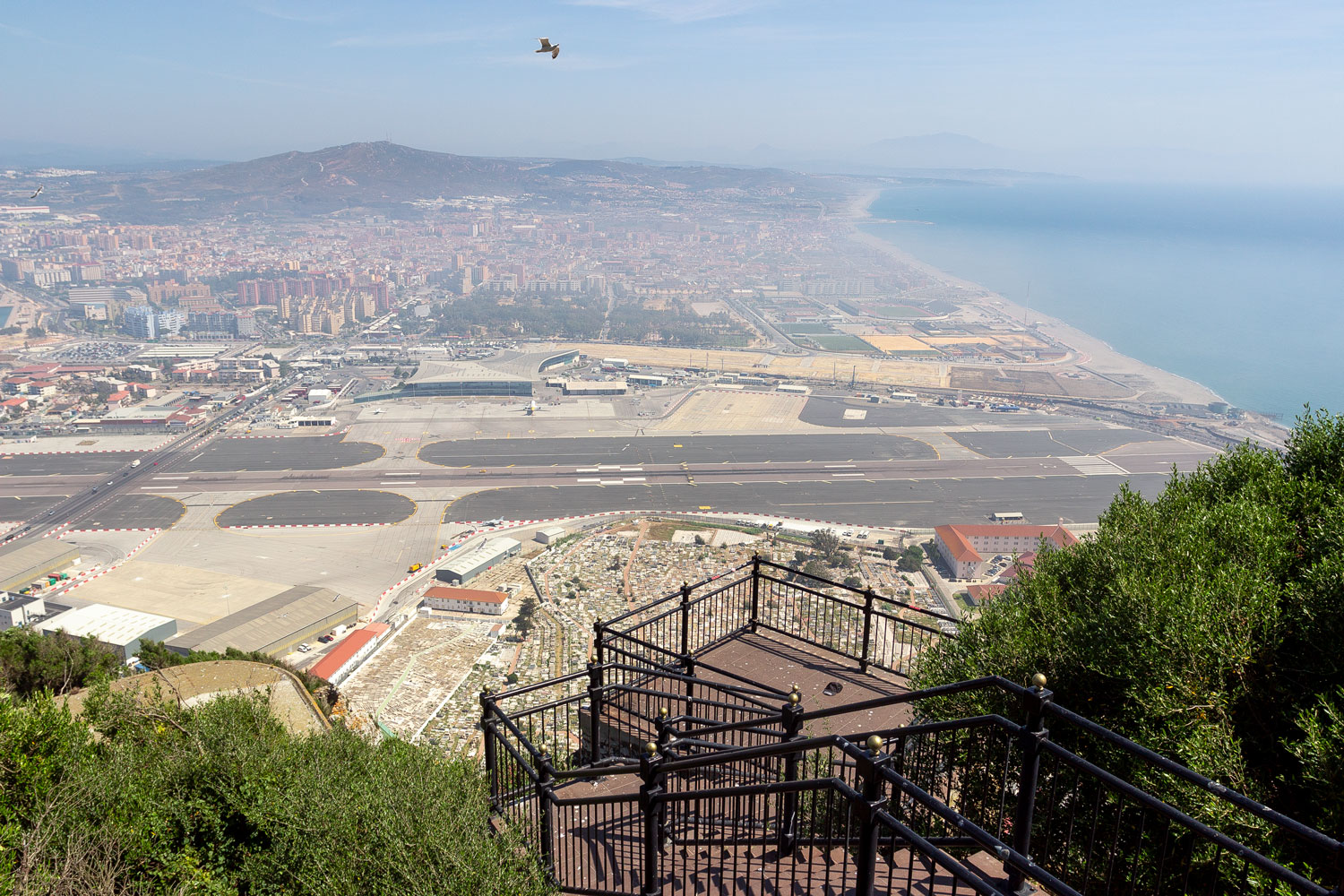
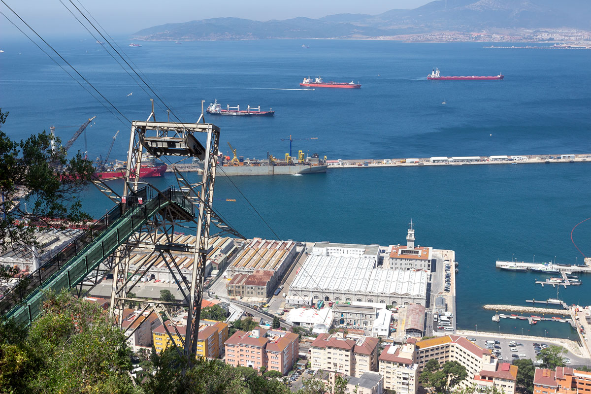
From a height, it can be seen that the former military airfield has now been transformed into Gibraltar’s passenger airport, still serving as a separation between the peninsula and Spain.
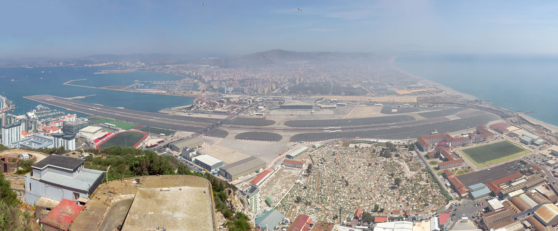
Between the airport and the city lies a large cemetery, which has existed since the mid-18th century. Soldiers from both World Wars are buried here.
Gibraltar is gradually being filled with high-rise “panel buildings.” When the land runs out completely, the British might start building homes right into the rock, similar to what the Saudis do in Mecca.
Several observation decks are set up on the rock.
The wind here blows with such monstrous force that it’s difficult to hold a camera steady. Meanwhile, clouds constantly envelop the rock itself, and the seagulls, swarming around like bees, seem to have no control over their flight, surrendering completely to the perpetual hurricane.
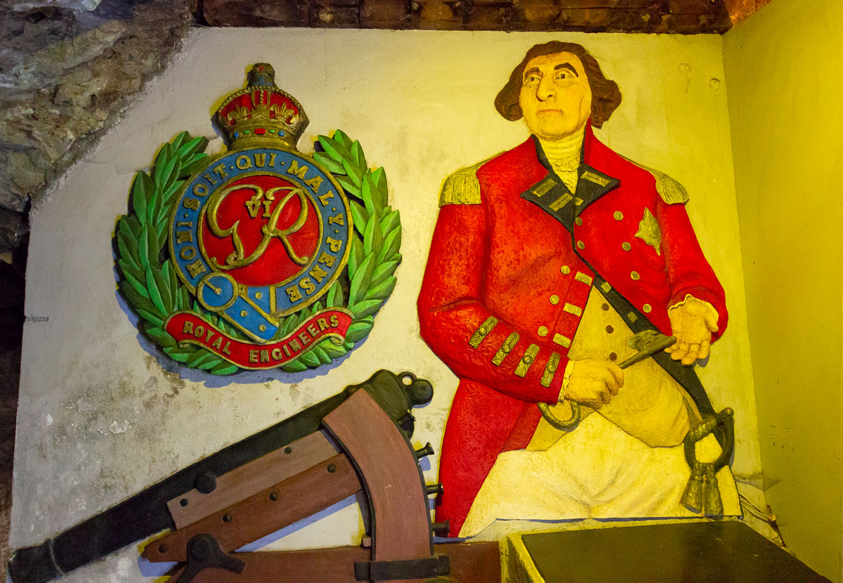
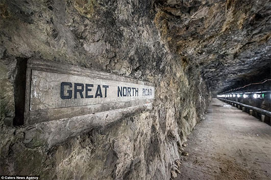
However, the Rock doesn’t only expand in height and width, but also extends far into its depths — it is riddled with military tunnels from the Second World War, First World War, and even older passages and passages that were built as early as the 1700s.
The main siege of Gibraltar occurred in the late 1790s when Spain and France attempted to recapture the Rock. Neither country succeeded in defeating this piece of Great Britain. By that time, Gibraltar was already fully fortified, but the most significant defense measure was the excavation of the Great Siege Tunnels.
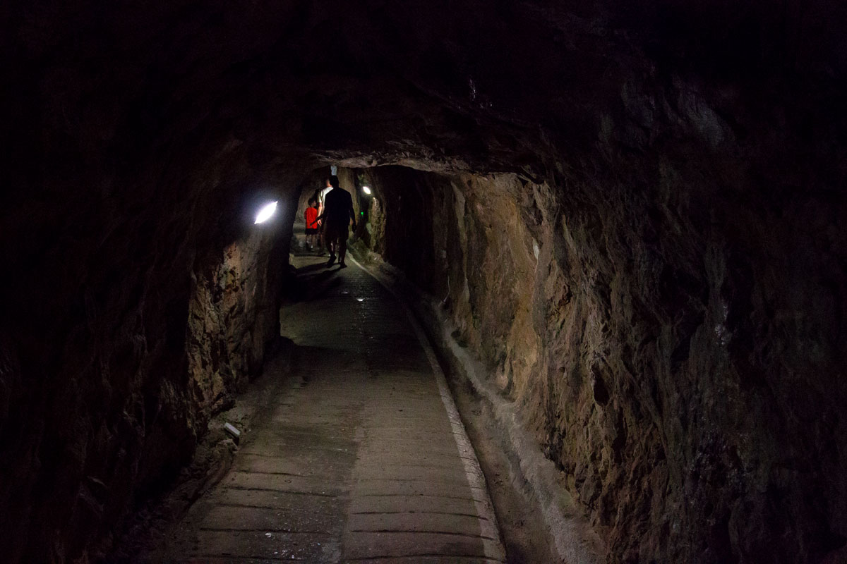
The length of the tunnel is 1.2 kilometers, while the entire Rock is only 3 kilometers long. However, the tunnel does not penetrate the Rock from one end to the other, but is concentrated in a winding network of passages with several levels in the northern part of Gibraltar. It will take at least an hour to go through the entire tunnel with all its branches and hidden corners.
This kilometer-long system was dug manually for almost 90 years using hammers, crowbars, and bags of explosives. When the war was approaching, they managed to tunnel through the Rock and create an opening on the northwest side.
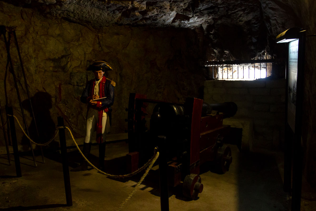
With the help of tunnels, the English managed to equip Gibraltar with cannons from all sides. As a result, the siege by two of the world’s strongest armies, which lasted for 4 years, ultimately choked without overcoming the tiny hill.
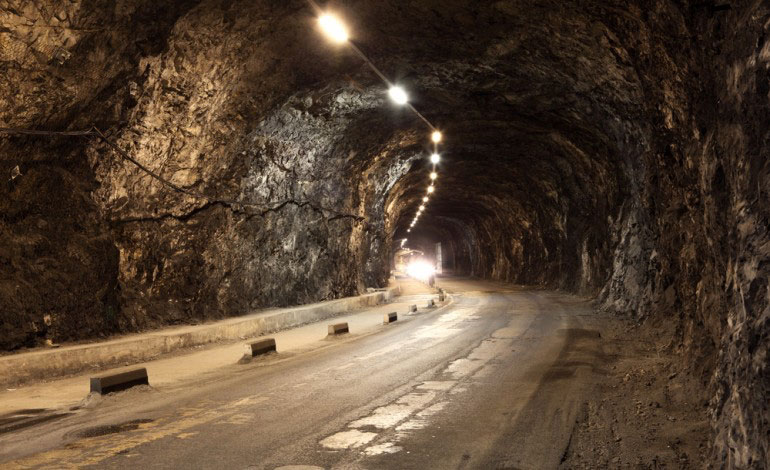
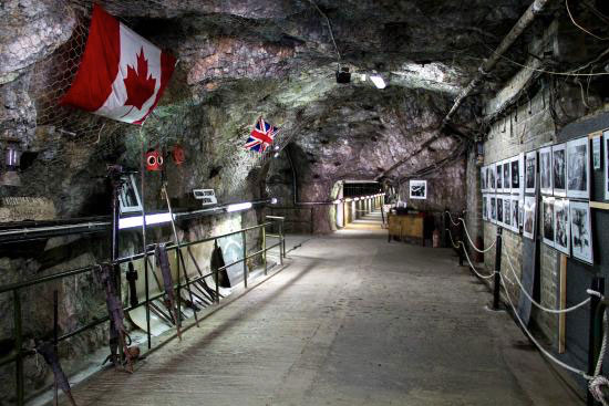
Since then, Gibraltar has not experienced any sieges, and the tunnel system has been expanded several times: at the turn of the 20th century, then before the Second World War, and finally during the Cold War era.
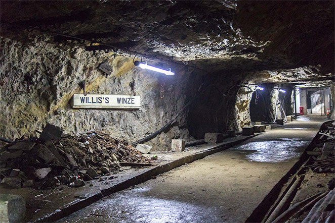
By the time of the Second World War, the tunnel network had transformed the Rock into a literal underground city. The length of the passages increased to 40 kilometers, an unimaginable number that was ten times longer than the entire length of Gibraltar!
Within the depths of the Rock, everything necessary for a prolonged siege of the fortress was located: here you can find a telephone center, a power station, a water distillation station, as well as a hospital, a bakery, numerous storerooms, and even an auto service for military trucks.
In case Gibraltar was captured by the Nazis, a secret cave with a stockpile of food and ammunition was also prepared, capable of accommodating 6 people and allowing for covert enemy fire. The existence of this cave was not known until 1997. It is difficult to imagine how many more secrets are hidden within the Rock. Even after a walk through the open tunnels, it becomes evident that Hitler would not have taken Gibraltar.
But the internal ecosystem of the Rock does not end with the military tunnels. In another part of the city, there are caves that are 20,000 years old. The mind has barely processed the impressions from the military tunnels when Gibraltar presents something completely new, even more stunning.
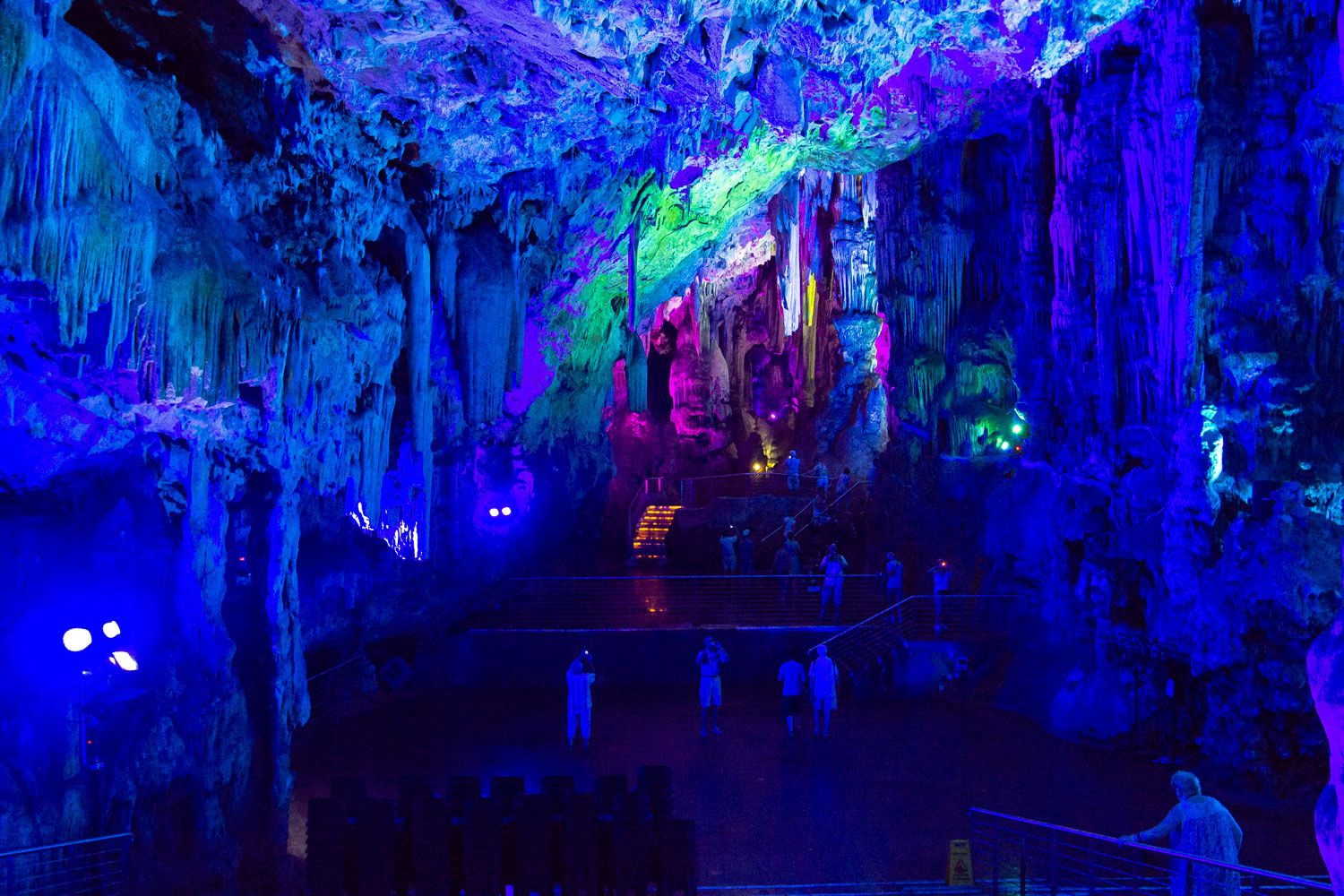
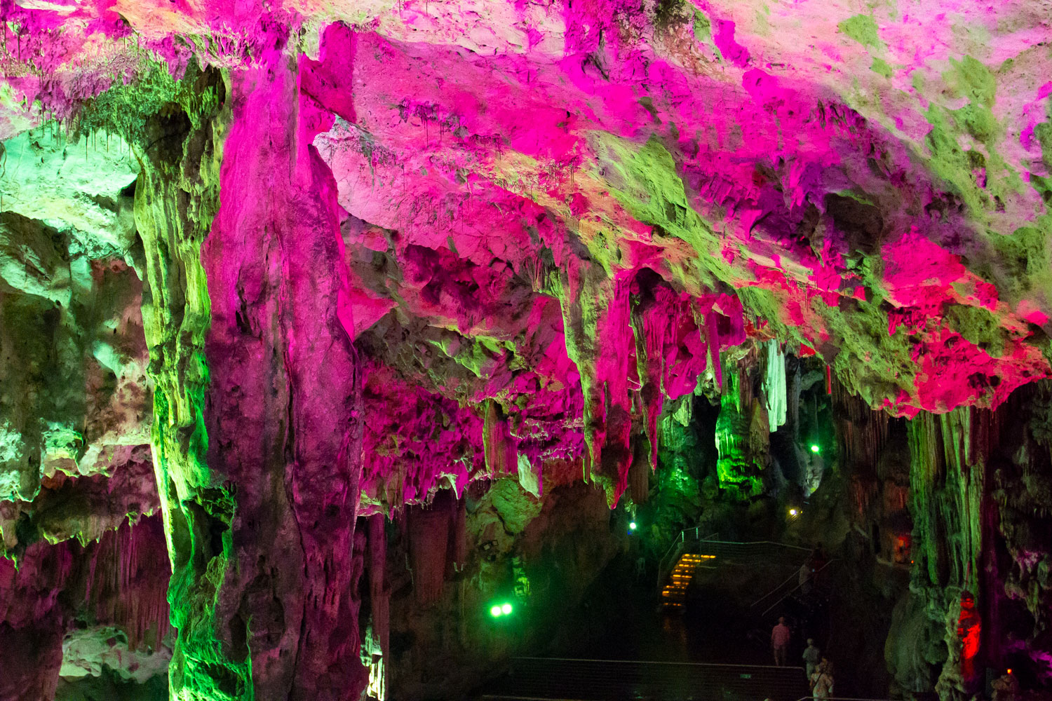
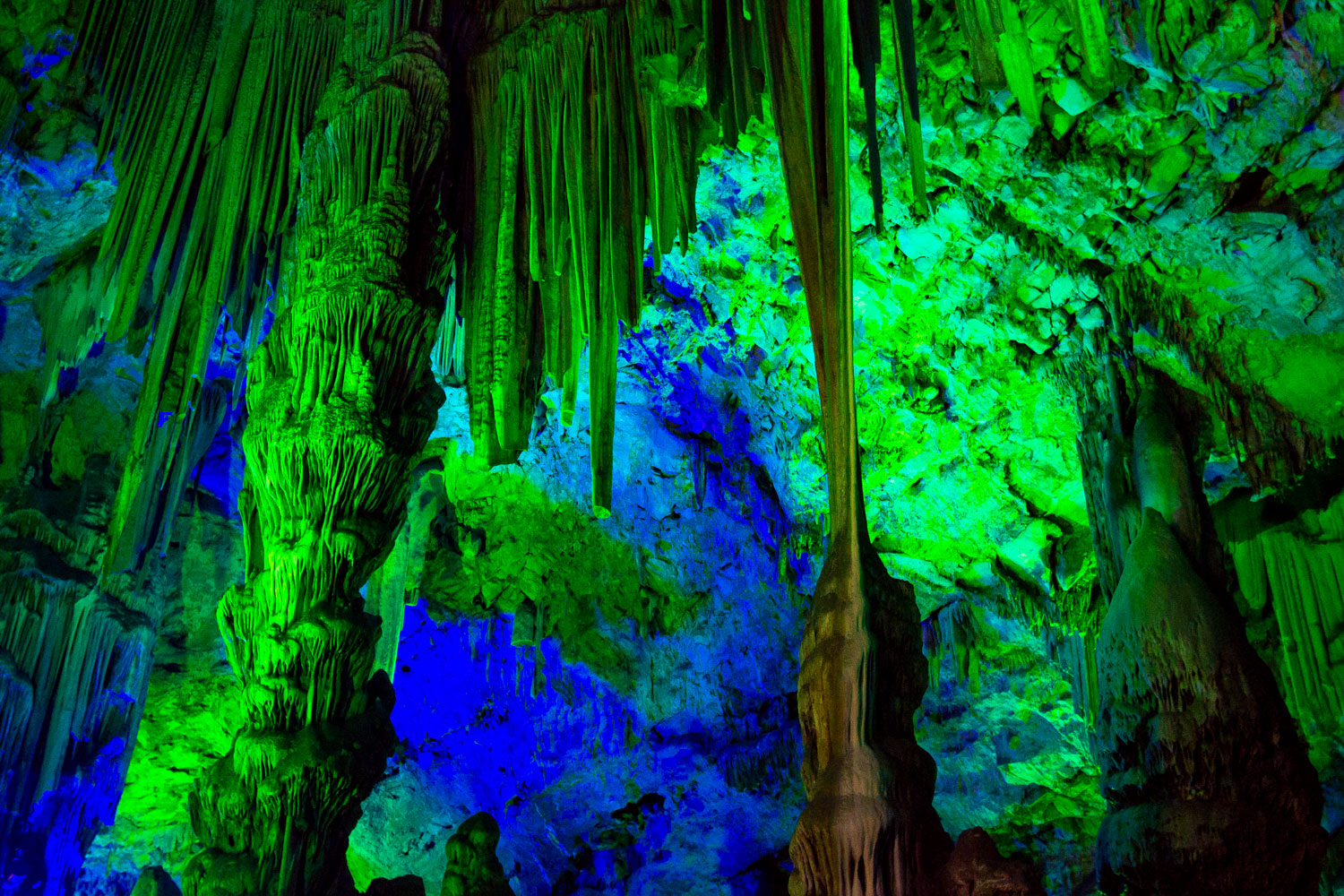
Please disperse, there’s nothing to see here. Gibraltar has set up a discotheque in a prehistoric cave with stalactites.
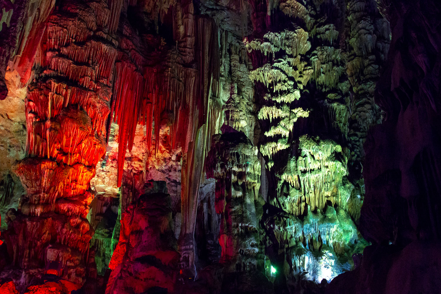
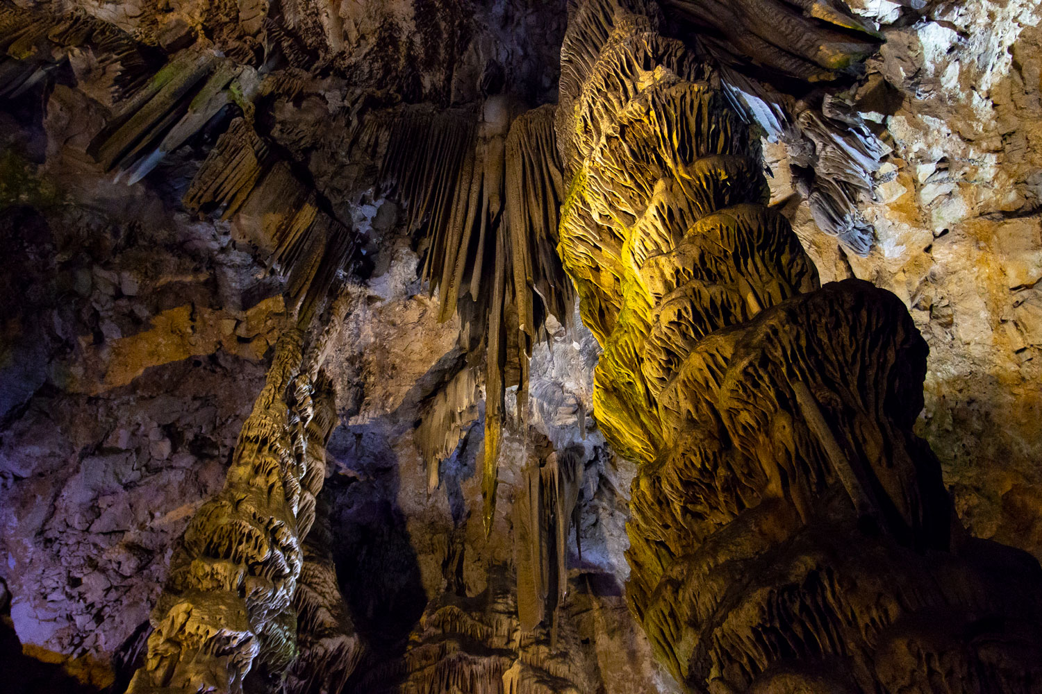
This is the second greatest audacity of the Anglo-Saxons after the invention of private property.
⁂
I wiped the sweat off my face and walked with trembling legs. I had only 5 hours to explore Gibraltar, and by midday, it became clear that I wouldn’t have enough time to see even half of the Rock.
Skipping the tour of the Second World War tunnels, I picked up the pace. Emerging from the Great Siege Tunnels, I almost ran towards the caves. After recovering from the caves, I realized that I could barely manage to simply walk to the end of Gibraltar.
Above the caves, there was a mountain road.
At the end of these stairs leading to the sky, there was a colony of Barbary macaques, the only one in Europe and rare even for Africa.
Barbary macaques are considered the main attraction of Gibraltar, and throughout the peninsula, signs are hung prohibiting feeding them under the threat of a heavy fine. Tourists used to feed the monkeys so much that they became dependent on humans and instead of hunting, they started raiding grocery stores in the city.
According to legend, Gibraltar will remain British as long as at least one monkey is alive.
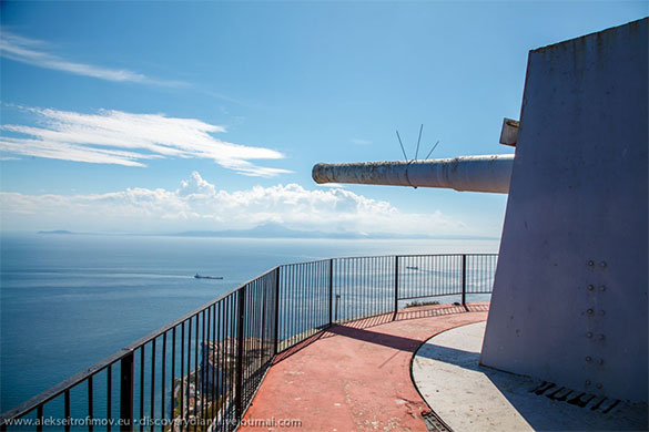
The staircase leads above the Barbary macaque colony and leads to the highest point of Gibraltar accessible to travelers. From here, you can see the British military base, and there is a restaurant and an old military battery, with cannons aimed directly at the strait.
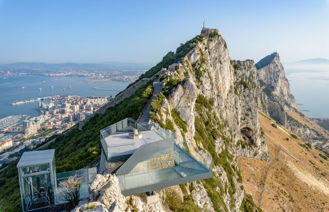
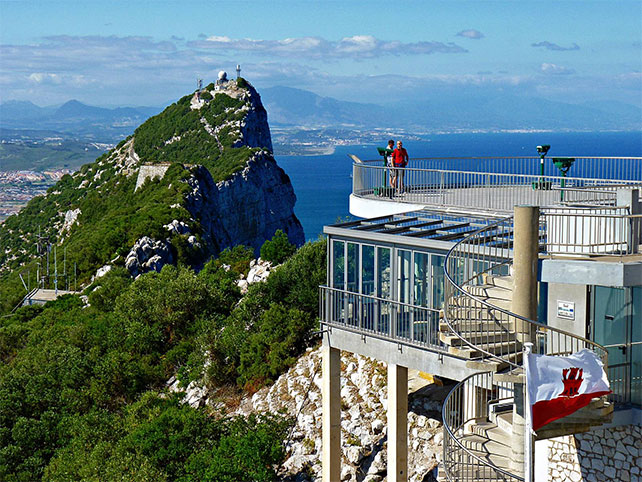
You don’t necessarily have to climb up the Rock on foot. A cable car of remarkable construction can take you there for a small fee, but I find myself exactly halfway between two stations. Descending from here is not possible, and I don’t have the strength to go up.
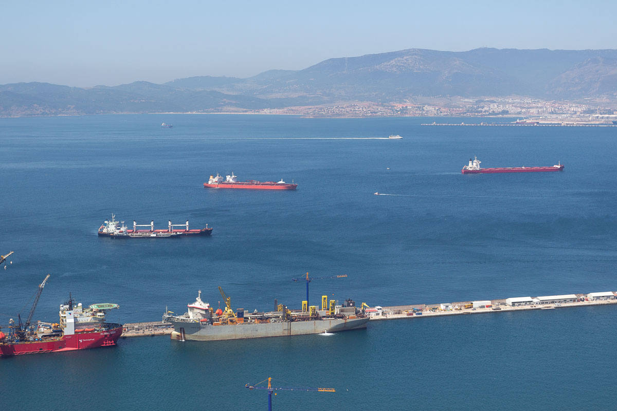
And here I am, unable to explore the dwarf state the size of the Kremlin in just five hours, tired and exhausted from the crazy rush, left only with sadness as I gaze into the distance where cargo ships sail by.
Only remains to look at the city, supporting Hercules’ column.
I still find the strength within me to make one final leap to the north — and behold, at the edge of Europe, a mosque appears. Gibraltar is the mountain of Tarik, the Muslim conqueror. Everything is in order, the mosque fits perfectly here.
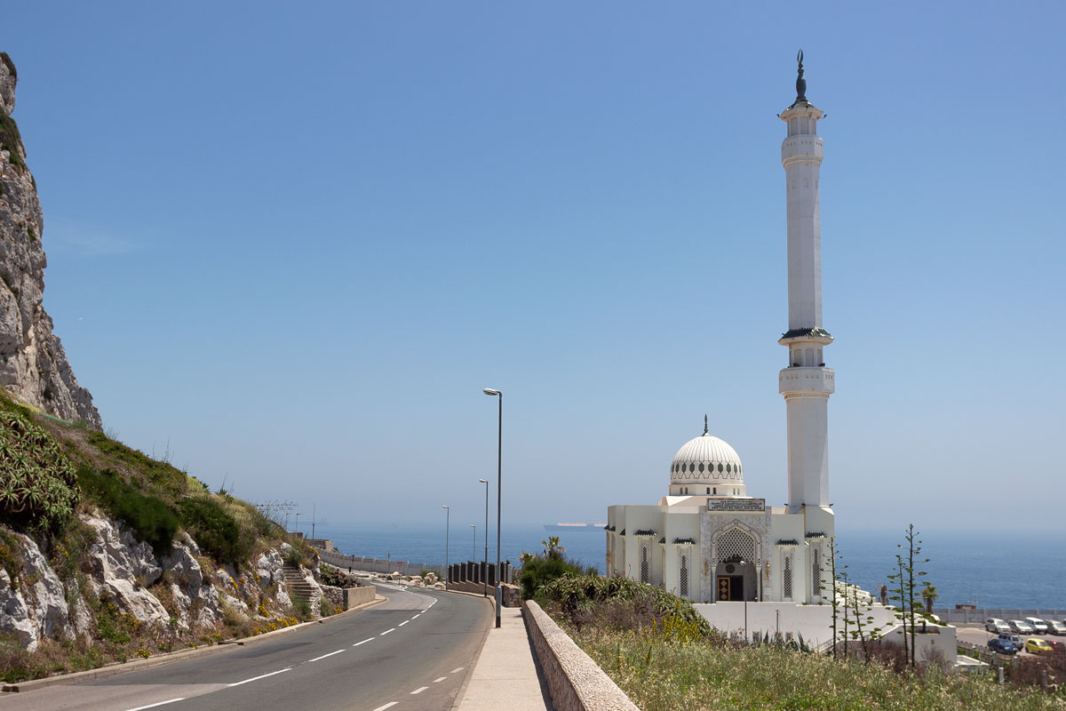
Somewhere at the far end of the horizon, the coast of Africa is visible, with an equally symmetrical cliff.
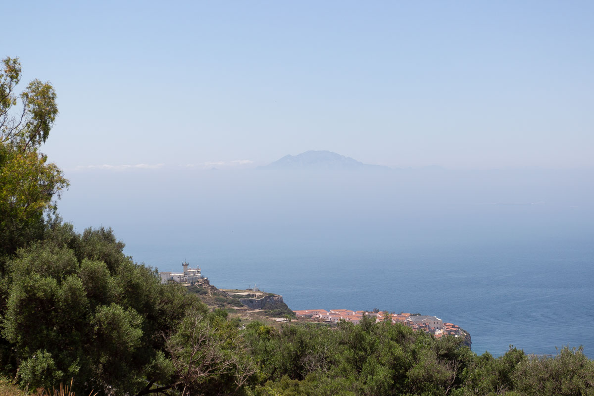
I look at it and think about how I will soon travel to Morocco and see Europe from the opposite side.
I look, and behind me remains Gibraltar with its titanic, incredible cliff, the waving British flag, and the white minaret of the mosque.
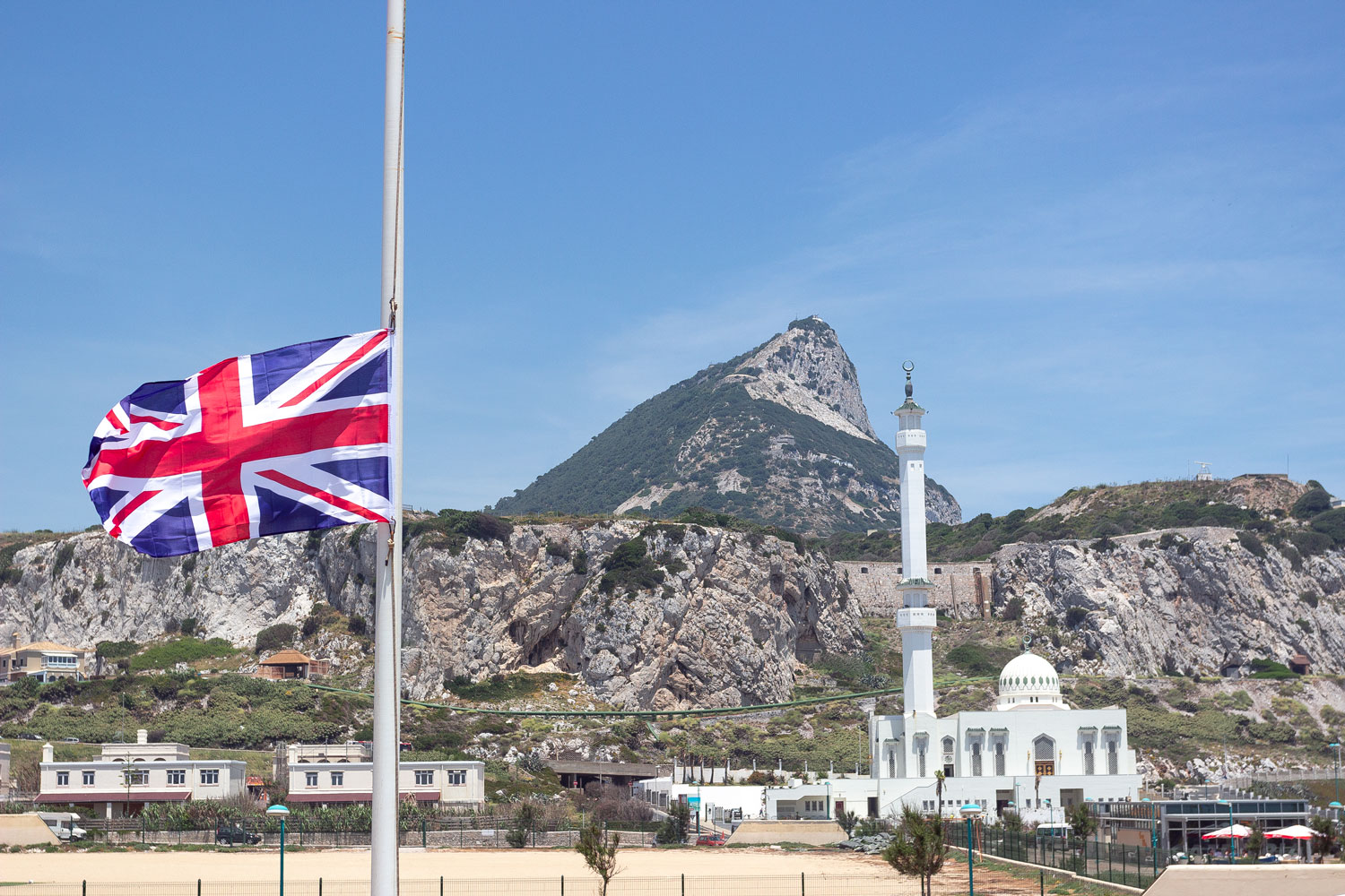
Yes, typical Britain.